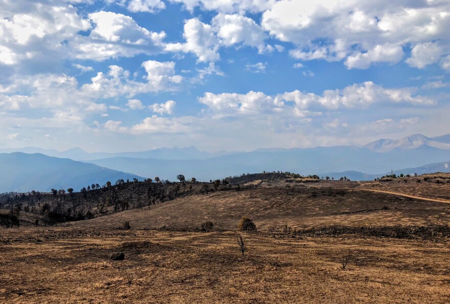
It’s been a few weeks since the Lake Christine Fire tore along the hillsides above Basalt and El Jebel. The flames are gone, but the evidence of the fire is clear on the blackened landscape. It’s a haunting change from the usual green or gold slopes; newspaper columnists have called this a "hellscape."
But seeing black after a wildfire is actually sort of a good sign.
“As organic matter burns, black is the first color you will see on a light burn, white's kind of intermediate, red's when organic matter has burned a lot," said Beth Anderson, a soil scientist, with U.S. Forest Service’s Burn Area Emergency Response (BAER) Team.
This group includes hydrologists, engineers, biologists and weed specialists. On Thursday, the Forest Service released their analysis of how the fire could impact the landscape and watershed. It assessed the damage caused by wildfire, and the likelihood of floods and mudslides that often follow.
“One thing that we look at is soil structure,” Anderson explained, digging in black dirt on the south side of Basalt where the fire burned on July 3 and 4.
In a healthy ecosystem, the soil and vegetation work together to absorb rainwater, but when the grasses and plants are burned away and rain hits bare ground, it’s up to the soil to deal with the water. If it’s been badly burned, the soil isn’t able to do its job very well.

But here, things look pretty good. When Anderson broke it apart, you could see roots that are still in place, and the soil stayed in chunks.
“So this right here, I would say this is an unburned soil,” she said. “There wasn’t a lot of ash on the surface, the roots are still intact and the structure is still intact.”
About a quarter of the burn area saw low impacts like this. More than half of the soil was moderately burned, and a smaller percentage was severely impacted. Anderson pointed out each type within a three-foot circle, including some severely burned, reddish soil under a scorched log.
“When I pick it up, it just kind of dissolves,” Anderson said. “There’s not that structure.”
The soil crumbled in her fingers, running through them like sand. These soils may repel water, causing it to run off instead of absorbing into the earth, and they account for about 12 percent of the burn area.
“It’s almost like paving the watershed,” explained Liz Schnackenberg, hydrologist and BAER Team lead.
The BAER Team report says areas that have flooded before the fire will see an increase in magnitude — and more frequent events. The U.S. Geological Survey (USGS) created a map showing the probability of floods and mudslides in the burn area; it’s up to 80 percent in some areas.
“But I do think that this terrain will offset some of that,” Schnackenberg said. "This is a broken, lumpy, bumpy landscape.”

Schnackenberg said there’s a lot of uncertainty in the USGS model and it likely overestimates dangers, in part because of Basalt Mountain’s unique topography. Instead of one or two major valleys coming down the hillside, there are a lot of little drainages and many of them lead into flat meadows.
“That can be a good thing because that means lots of little areas that water can settle out in, that sediment can be deposited in,” she said.
There are still areas of concern. The BAER report recommends implementing an early warning system that can alert people if flooding or debris flows are likely during a major rain.
There are already signs of new life on Basalt Mountain.
“You can already see that the vegetation is returning,” Anderson said, pointing out fresh grasses and new oak brush.
With some more rain, grasses and shrubs will likely come back in a couple of months. It’ll take longer for the juniper trees to recover.
The post-fire landscape is changed, certainly, but the charred black will gradually turn to green.
"It actually can be a really unique landscape, and an opportunity to see that landscape reset itself,” Schnackenberg said. “Fire is a natural part of the ecology, and a natural part of the ecosystem."
And, generally, the landscape is able to recover.


