It’s been a hot summer across the western United States, and human-caused climate change will continue to drive temperatures higher.
In the Mountain West, heat impacts drought conditions, outdoor recreation, and health outcomes, especially in rural communities, but it can be hard to get accurate data on heat in rural areas, whose economies are dependent on the outdoors.
In Moab, Utah, the city is hoping to gather data to help with heat mitigation strategies — and they’re using volunteers to help with their efforts.
Just before 3 p.m. on July 19, 2025, Mimi Drozdetski is attaching a heat sensor to the passenger window of Adrienne Corticelli’s car in the parking lot of a Moab grocery store.
Drozdetski holds the sensor in place at the top of the window, while Corticelli rolls the window up for it to click into place. She then locks the window, in case she accidentally bumps the button.
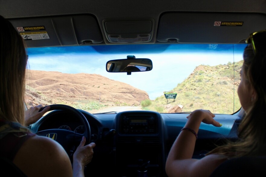
As they pull out of the parking lot, the air conditioning is turned all the way up, as it’s almost 100 degrees outside. Corticelli is driving, while Drozdetski is taking notes and navigating. Though they both know Moab pretty well, they’re meant to be driving a specific route, and Drozdetski reminds Corticelli on which intersections to turn.
As they travel, Drozdetski explained that the sensor is gathering a ton of data.
“It collects the air temperature, relative humidity and GPS points at one second intervals,” she said. “Then that'll be used, with machine learning, to actually generate a whole map of the area.”

It’s part of a larger campaign by the city of Moab, to take a detailed inventory of heat in the city. Corticelli and Drozdetski drove this route earlier in the day, at 6 a.m., and Corticelli will drive it again at 7 p.m. Other volunteer pairs are doing the same thing, on other routes in other parts of town.
“We're gonna have a really high quality ground level heat map in like, morning, afternoon, and evening,” said Carrie Schwartz, director of local nonprofit Science Moab. “We can kind of figure out secret hotspots or where is actually surprisingly cool, what kind of strategies could we use to like cool areas that are most at risk.”
Moab had previously received a grant from the Center for Collaborative Heat Monitoring to do this data collection and heat mapping project in partnership with Science Moab, using federal funds and data from NOAA. The city later learned that the grant was terminated because the program did not align with the Trump administration’s priorities, though not before it received some of the money. City officials say they were able to spend that money on community engagement, educational materials for distribution, mileage compensation, and refreshments for volunteers.

“We all know it's hot, but that doesn't necessarily mean we know the most efficient targeted strategies to actually mitigate that heat,” Schwartz said.
She says that’s where the data gathered during this campaign comes in — helping the city make decisions about heat based on data.
“Are there places in town that we want to turn into cooling centers? Where are areas that need more natural cooling in the form of shade, et cetera?”
More than that, Schwartz says, this campaign is in response to things residents have been noticing. A lot of those observations came when the city was drafting its updated strategic plan in 2022, and did community outreach to see what residents wanted prioritized.
“That was one thing that folks said loud and clear is that, ‘you know, we're seeing intensifying heat, wind, flooding, like, these are things we're gonna have to continue dealing with in the future. What is the city doing to help us mitigate the risks of those intensifying climate events?’”

Corticelli, who lived in Moab nine years ago and moved back this past fall, is among those residents noticing changes.
“The LaSal (Mountains) over here, they used to have snow on their peaks — really, July and August were the only two months where they did not,” she said. “I did notice that the snow was melting sooner, and by June it was gone.”
Moab is different from places like Phoenix or Las Vegas, cities that have done extensive heat mapping in response to extreme temperatures.
It’s rural and remote, known for its stunning desert landscapes found in national parks and other public lands. People come from all over the world to hike, mountain bike, rock climb, and off-road in Jeeps and side-by-sides. It’s why people like Drozdetski and Corticelli live here.
“I always just love hiking. I've been getting into climbing and I just got a kayak, so it's been nice getting out onto the river finally,” Drozdetski said.
“I'm a hiker,” Corticelli said. “I just hiked and camped all my life. And I have a bike… I ride my bike far more than I drive.”

The route that Corticelli and Drozdetski are driving reflects that culture. They pass through a few residential areas, by the high school and the grocery store, but they also go to some of the most popular trailheads in town.
At the Sand Flats Recreation Area, there’s a gaggle of people with ten or so trailers, all towing off-highway vehicles, and the trailhead at the Mill Creek Canyon Trailhead is also full. Drozdetski says this hike is a great way to cool off, thanks to a swimming hole and some small waterfalls.
This is just the first part of the city’s campaign. In addition to the routes driven by these intrepid citizen scientists, volunteers will also install stationary heat sensors at a few key locations, both on buildings in town, and at popular trailheads. (The remaining funds the city has from the grant will be spent on maintaining the stationary sensors. The city provided supplemental funding for those after the initial grant was terminated.)
Corticelli has volunteered to do that, and will back up the data every two weeks.
“I said I would take the one at Hell's Revenge,” she said, located in the Sand Flats Recreation Area where we saw all the off roaders. “It’ll give me a reason to come up here. Maybe I'll actually come up here and hike then when I do that, especially as the weather gets a little bit cooler.”

Carrie Schwartz with Science Moab says they’ll have researchers and data experts helping them, but it was important that they get the community involved early on.
“Nobody knows our community better than we do, right? The folks that live here and love this place.”
She says the city will need this data to build a more resilient community — not just for the people who live here, but the millions of visitors who come to the city and its public lands every year.
Copyright 2025 Rocky Mountain Community Radio. This story was shared via Rocky Mountain Community Radio, a network of public media stations in Colorado, Wyoming, Utah, and New Mexico, including Aspen Public Radio.


